The Hill of Faughart
Some landscapes in Ireland are more weighted with the past than others, but for a truly monumental depth of history, there are few that can compare to the Hill of Faughart in County Louth. The Hill of Faughart is part of a prominent drumlin ridge, with an extensive vista that overlooks the town of Dundalk and Dundalk Bay. Historically, the Hill of Faughart had a key role in commanding a number of passes through the Fews Mountains into South Armagh, including the famed Gap of the North that featured so prominently in the epic Táin Bó Cúailnge. With its strategic dominance over the surrounding landscape, it is no wonder that it became a place of significance for centuries. This significance can be seen in the variety of archaeological monuments on the hill, and in its role as a setting for key events in Irish history.
Aerial photography has revealed cropmarks that show that the central complex on the hill is surrounded by large circular enclosures. This is typical of early medieval monastic sites, such as Clonmacnoise. Though these enclosures have not yet been excavated or radiocarbon dated, they may represent the remains of an earlier Bronze or Iron Age hillfort, such as the one that surrounds the Grianán of Aileach in Donegal.
This article details some of the key features that you can find on the Hill of Faughart, along with some of the many stories that the hill bore witness to.
For practical information about visiting this site Click Here
An aerial view of the monuments on the Hill of Faughart facing south-east towards Dundalk Bay • Louth
Old Faughart Church
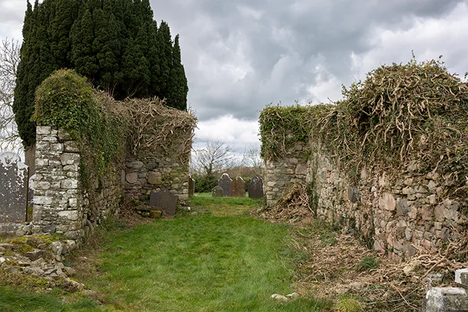
The ruined medieval church • Hill of Faughart
The most tangible feature on the hill is Old Faughart Church. This is a relatively small medieval church that probably began as a simple single-roomed stone church in around the 12th century, before an extension was added later in the medieval period to form it into a nave and chancel church. A small amount of archaeological excavation was carried out by Lil O’Connor in the 1960s to learn more about the church. The dig revealed that the church’s foundations rest on hard boulder clay, though a small part of the western wall rests on an occupation layer that had 11th–12th century pottery. This suggests that the stone church could be no earlier than the 12th century, though it may have replaced an earlier wooden structure as is relatively common with early Irish church sites.
St Brigid’s Well
Of all the rich historical associations the Hill of Faughart, it is its connection with Saint Brigid that remains the most celebrated today. The life and legacy of St Brigid of Kildare has spanned more than a millennium, crossing both continents and creeds. The woman who would become the female patron saint of Ireland was likely born sometime in the AD 450s or 460s (perhaps as early as the late 430s), with the annals indicating her death around AD 524.
Brigid was alive during a pivotal period in Irish history, as Christianity began to take hold in Ireland. Indeed, she was likely born into a pagan community, converting either as a child or teenager. Just as her life traversed a period of religious change, so too has her cult. Many associations and attributes linked her with the earlier goddess Brigit / Brigantia. One example is St Brigid’s feast day of 1 February, which falls on the same date as the pagan Imbolc festival which marks the beginning of Spring.
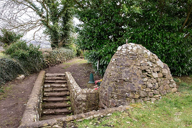
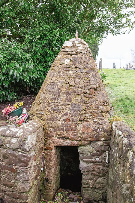
St Brigid’s Well • Hill of Faughart

St Brigid’s Well • Hill of Faughart
There are [contested] claims that Brigid was born on the Hill of Faughart, and the church on the hill is dedicated to her. The holy well, situated within the graveyard just north-west of the church, is still a place of veneration and activity to this day. The well is accessed by a set of stone steps, and it is covered with a corbelled canopy of stone that was constructed between 1900 and 1924. The Archaeological Survey of Ireland indicates that a number of penitential stations are located to the west of the main complex, but unfortunately they cannot be visited today as they are on private land. However, the fact that they were recorded as ‘St Brigid’s Station’ on the 1938-9 Ordnance Survey map tells us that there was once a turas or pattern day tradition here, perhaps along the lines of the Turas Glencolmcille. The granite block in the graveyard known as St Brigid’s Pillar may be another station, though the tenon joint in the stone might suggest that it served as the base of a cross. A small fragment of a cross was found during conservation work in recent decades, and it is now in Dundalk Museum.
St Brigid’s Bed
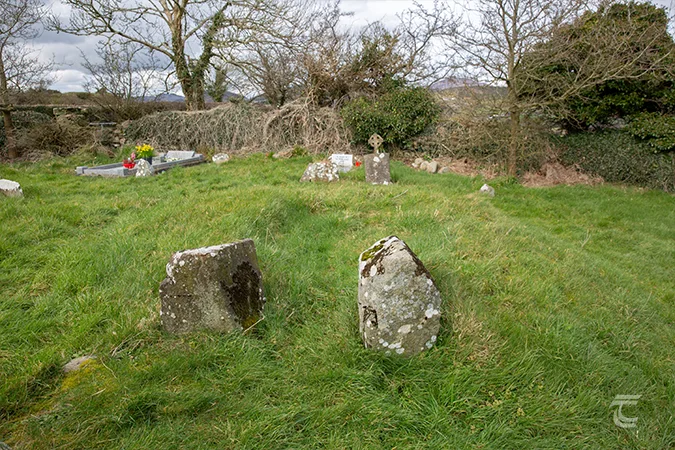
St Brigid’s Bed • Hill of Faughart
Another feature that served as one of the penitential stations is St Brigid’s Bed. This roughly horseshoe shaped bank has two large stones flanking a gap, appearing to form an entrance. This feature was examined by Lil O’Connor, who found a large black slab in the central area of the feature, with stones lining the inner face of the bank. It looks like it may be the foundational level of a small structure, possibly an oratory, clochán, or perhaps a small tomb shrine. The name ‘St Brigid’s Bed’, is similar to other relic shrines from the early medieval period like Leaba Cholmcille at Glencolmcille. It is intriguing to wonder if any of Brigid’s relics were once housed here.
The Battle of Faughart and the Grave of Edward Bruce
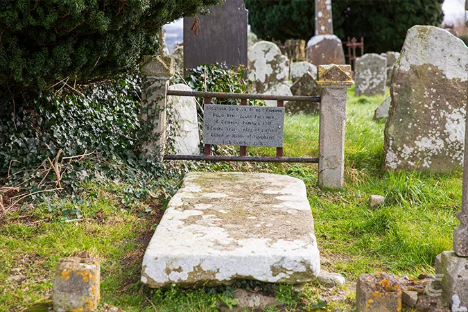
The grave of Edward Bruce • Hill of Faughart
A large granite slab and small marble plaque mark the site of one of the more notable people said to be buried in the quiet graveyard on the Hill of Faughart, Edward Bruce, the brother of the Scottish King Robert the Bruce, and claimant to the title High King of Ireland. Edward was killed at the Battle of Faughart that took place on the hill on the 14th October 1318. The battle was the culmination of the Bruce Invasion that began in 1315. Edward had led a Scottish army to Ireland in response to a request for aid by Domnall Ó Neill, and perhaps as a way to open another front in the long Scottish campaign against the English.
The three years of brutal warfare triggered by the Bruce Invasion amounts to the largest conflict in medieval Irish history. It proved a pivotal moment for medieval Ireland. Towns were sacked as rival armies laid waste to the large tracts of the island. This war devastated a society also reeling under the weight of the Great European Famine (1315-18). When the conflict finally came to an end an estimated 10-20% of the population had died.

The grave of Edward Bruce • Hill of Faughart
The bloody Battle of Faughart was the final act of the war. Edward Bruce led his men through the Moyry Pass, only to be confronted by an Anglo-Irish army under the command of John de Bermingham and Edmund Butler. Rather than wait for support from his Irish allies, Edward rashly decided to go on the offensive and try to sweep his enemies from the field. It was to prove a fatal mistake. As described in an account in the broadly contemporary Lanercost Chronicle:
‘[the Scots] were in three columns at such a distance from each other that the first was done with before the second came up, and then the second before the third, with which Edward was marching, could render any aid. Thus the third column was routed, just as the two preceding ones had been. Edward fell at the same time and was beheaded after death. His body being divided to the four chief quarters of Ireland.’
With Edward Bruce’s body being distributed, it is unknown how much, if any, of the Scottish leader is interred on the Hill of Faughart. But it is a compelling connection to one of the bloodiest and most harrowing episodes of Irish medieval history. Fin Dwyer discusses the Bruce Invasion and its aftermath in this Tuatha Talk, this recording is exclusively available for Tuatha Members.
The Motte on the Hill of Faughart
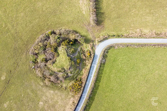
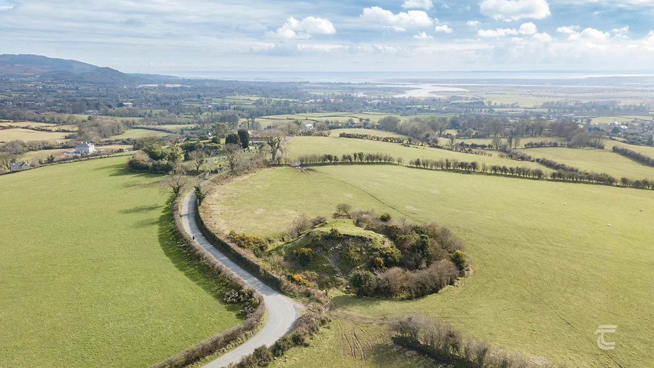
Aerial view of the motte • Hill of Faughart
A prominent earthen mound known as the Motte is located along the road, around 150m north-west of the graveyard. It occupies the summit of the hill, and consists of a steep-sided, but eroding, mound of earth that stands nearly 8m high. It is surrounded by a ditch, or fosse. 18th century maps show a stone octagonal-shaped building on the summit, that may hint that it was refortified during the turbulent 17th century. Mottes are typically classified as fortifications that were erected by the Anglo-Normans during their first incursions in the late-12th century. It may also represent an hastily erected fortification during the period of the Bruce Wars, as the Hill of Faughart saw much movement of forces throughout those campaigns, even before the great battle of 1318. Though it may have an even older story to tell. A souterrain was recorded at the base of the motte in the early 20th century. Could this be evidence that the site originated as a pre-Norman castle during the 11th or early 12th century? This idea was discussed by Prof. Tadhg O’Keeffe back in episode three of Amplify Archaeology Podcast.
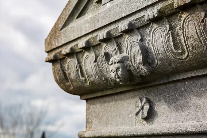
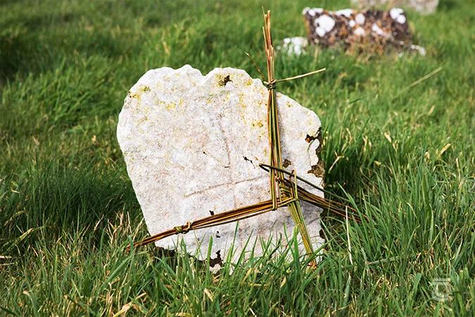
Upper left: a face from the past in the historic graveyard • Lower left: a St Brigid’s Cross on an early grave slab • Right: St Brigid’s Holy Well
Top: a face from the past in the historic graveyard • Middle: St Brigid’s Holy Well • Bottom: a St Brigid’s Cross on an early grave slab
The Hill of Faughart Visitor Information
There are few places that are as steeped in history and mythology, as this prominent hilltop that overlooks Dundalk Bay.
Explore more sites in Ireland’s Ancient East


